Photographing Westmoreland Falls
About Westmoreland Falls
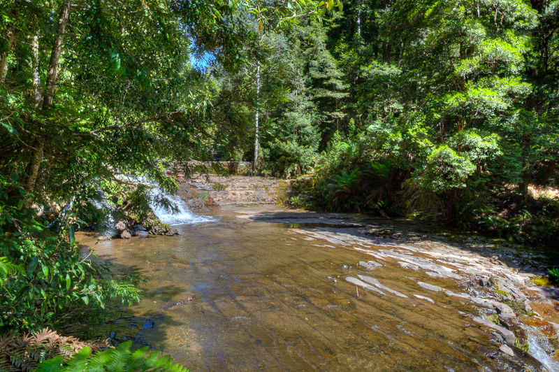
Westmoreland Falls are at the northern end of the Walls of Jerusalem. At this end, there are nice roads to get to a series of falls, and a series of scenic walks.
Viewpoints
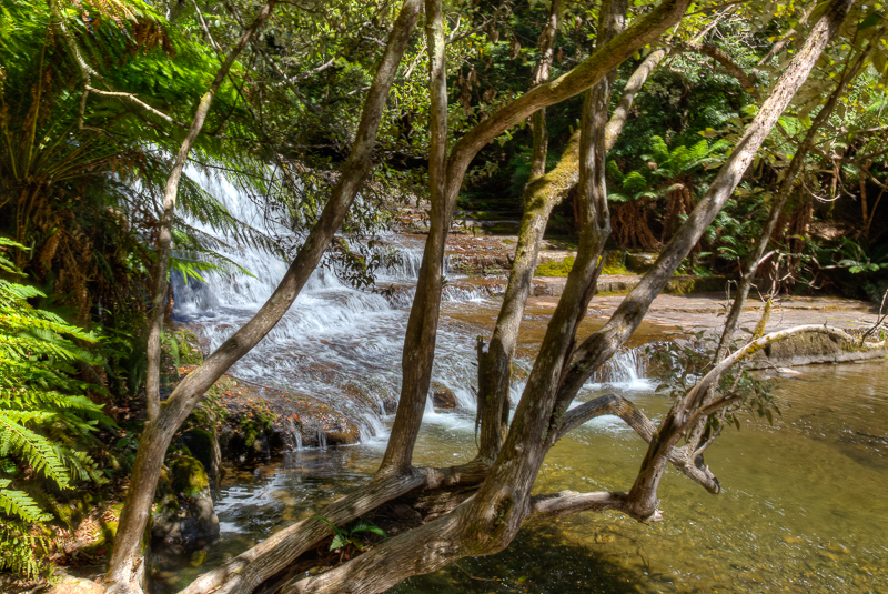
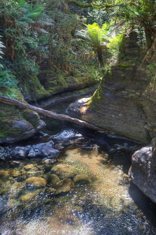
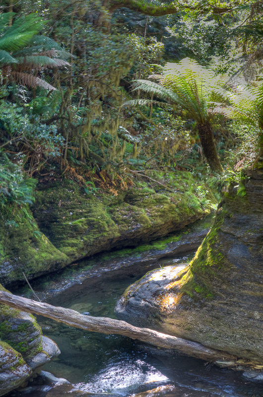
The path runs down the side of the valley that contains the river, and then joins / crosses the river near the bottom. Jenny got 'stuck' at the top of the path photographing the huge variety of macro shots - fungis and ferns, bark, and insects. I started taking photos about half way down and did not stop until Jenny called on the radio.
How I photographed the falls
What I took - what was in my kit
I took my LowePro Backpack loaded with Canon 5DMkII body, Canon 24-105mm zoom, Manfrotto 190 Tripod, and of course a range of lens wipes, spare batteries, sunscreen and bug repellant. I tended to shoot wide open at 24mm, and in hindsight, I should have used the 16-24mm.
Techniques
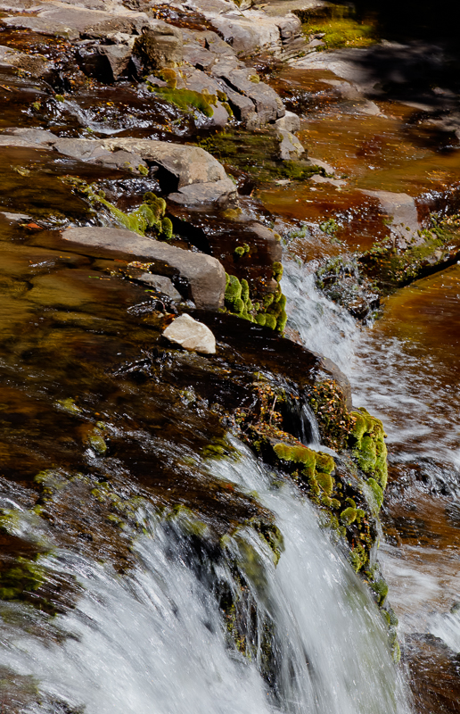
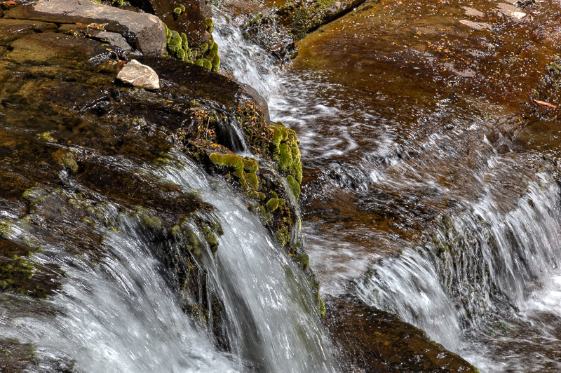
As with any waterfall, I want to blur the water but not the surrounding vegitation. That means using a long exposure and a tripod. I could have used NR filters, but in this case I didnt. I simply changed the aperature to suit. I was already shooting at ISO 100.
Other things to look out for
This is a brilliant area to be in for a landscape photographer. Nearby are Parsons Falls, Meander Falls, Liffey Falls, Champagne Falls and Lobster Falls, as well Mole Creek Caves, Cradle Mountain, Dove Lake, Walls of Jerusalem, Granite Tor, and Vale of Belvoir. I have spent two weeks here and run out of time. I think we have visited four times, but still cannot see enough.
Location
Westmorland Falls Track, Caveside TAS 7304 (-41.62023991, 146.39014)
Techniques used
Kit used
How to get there
This is definitely a car only spot to visit. That said, the road there is good and any 2WD car or motorhome etc. could do it. Most people would come to the site from Mole Creek. The C138 / B12 road crosses east-west at the end of the alpine region.
Best time to visit
I am not aware of any time that is better than any other here. In winter, there may be more water and the chance of snow. In summer, you get nice skies. At dawn / dusk you might be better light, but you also have to deal with walking in the dark and driving in the dark. (Note, it is easy to drive in the dark, BUT in country places like this, you will get a lot of wildlife moving around near dawn and dusk. This is when you hit a kangaroo, deer, or wombat. None of which are good for you, your car, or the animal.
Accessability
The road into the car park is good. After this there is 1km or so walk down the valley side on a dirt path. This path is the sort of path common in National Parks - well constructed, but still having tree roots, rocks etc. that need to be navigated. I would not recommend this for anyone with mobility issues.
Where to stay
Doloraine is the closet good sized town. It has hotels, caravan parks etc. Mole Creek has a small caravan park, and Cradle Mountain is about 40 mins away.